

Latest Weather Blog
Sunday AM Forecast: Dry air is here, cooler next week
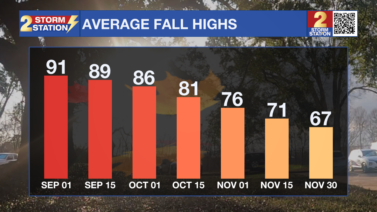
The cool front has passed through, and drier air is now filtering into the region. Another round of cooler air is on the way early in the week, delivering our first real hint of fall, with temperatures dropping to levels we haven’t seen since early June! Average temperatures in early September are still hot, but we're in the summer home stretch!
Today and Monday: After a few clouds this morning, expect mostly sunny skies both Sunday and Monday. Afternoon highs will reach near 90°, but the lower humidity will make for comfortable conditions. A light northerly breeze will enhance the pleasant feel. Just a few clouds and an isolated coastal shower are possible, but most areas stay dry. Overnight temperatures will fall into the upper 60s thanks to the dry air. Monday brings more sunshine, with highs topping out in the upper 80s.
Up Next: Another surge of dry, cool air moves in late Monday into Tuesday, reinforcing the fall-like feel. Morning lows on Tuesday will dip into the low to mid-60s, and afternoon highs will remain in the upper 80s. Humidity begins to creep back up by mid-week, though it should stay well below summer levels. Another round of drier air may arrive by week’s end, with temperatures holding near seasonal averages.
The Tropics: Disturbance 91L in the Atlantic has fizzled out. The remaining tropical wave will continue westward with no signs of redevelopment. The National Hurricane Center isn’t tracking any systems with potential for development over the next seven days — welcome news as we approach the peak of hurricane season.
Trending News
Get the latest 7-day forecast and real-time weather updates HERE.
Watch live news HERE.
– Dave
The Storm Station is here for you, on every platform. Your weather updates can be found on News 2, wbrz.com, and the WBRZ WX App on your Apple or Android device. Follow WBRZ Weather on Facebook and X for even more weather updates while you are on the go.
More News
