

Latest Weather Blog
Saturday PM Forecast: Widespread hard freeze incoming, thaw coming soon
The coldest point of this Arctic blast is here. Continue protecting people, pets, plants, and pipes for the time being. A thaw arrives in the Capital Area early next week.
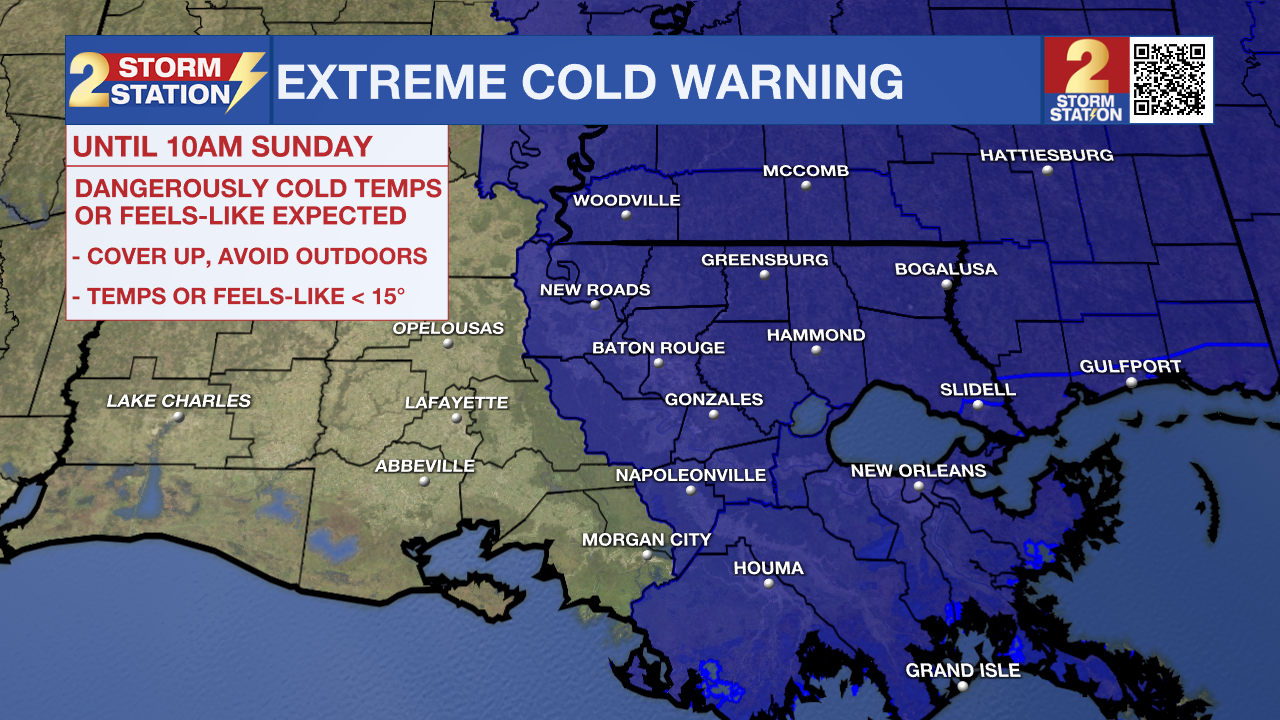
An EXTREME COLD WARNING remains in effect through 10 a.m. Sunday across all of southeast Louisiana and southwest Mississippi. Dangerous cold will be possible, especially in the hours surrounding sunrise. The extended deep freeze may also burst unprotected pipes.
If going outside late Saturday or early Sunday, dress in layers, including a hat, face mask, and gloves. To prevent water pipes from freezing, wrap, drain, or allow them to drip slowly. Keep pets indoors as much as possible. Make sure outdoor animals have a warm shelter, food, and unfrozen water. Ensure portable heaters are used correctly. Do not use generators or grills inside. Those without heat in their home can call 211 for assistance in locating appropriate shelters.
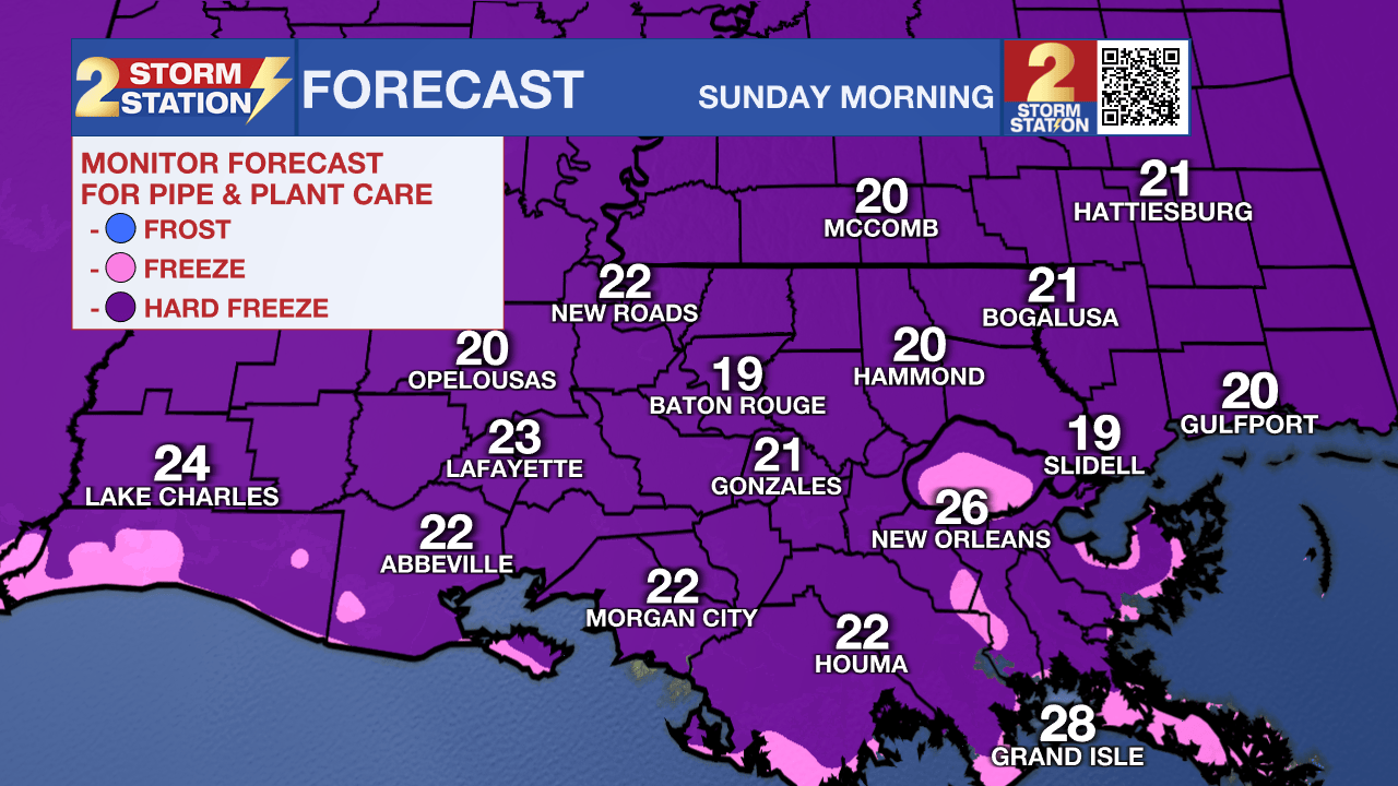
Tonight & Tomorrow: The Capital Area is in for a prolonged deep freeze into Sunday morning. Subfreezing conditions will last around 15 hours in Baton Rouge, possibly longer in a few locations. Temperatures will drop below freezing around nightfall and bottom out in the upper teens to low 20s early Sunday. This easily qualifies as a hard freeze. In addition to ensuring vulnerable outdoor plumbing is insulated, allow a slow drip for indoor faucets and open cabinets to allow warm air to circulate around the pipes. Remember, air temperature is what matters for pipes, whereas wind chill affects how cold it feels for people and pets. While a lingering breeze will make it feel a few degrees colder from time to time, relaxing winds will allow wind chills to line up more closely with the air temperature. After mid-morning, the temperature will rise above freezing. Look for a high in the mid-to-upper 40s by afternoon under a mostly sunny sky.
Up Next: Monday morning could bring another hard freeze, especially near and northeast of Baton Rouge. That said, temperatures will scoot closer to seasonal averages by afternoon. Tuesday will be even warmer with lows in the 40s and highs in the upper 60s, even with more clouds and the occasional sprinkle. This warmth comes ahead of the next cold front, which will bring a round of showers Tuesday night. A cooldown will follow, though it doesn’t appear as cold as the last two Arctic blasts. Moving toward next weekend, temperatures will rebound quickly.
Trending News

Get the latest 7-day forecast and real-time weather updates HERE.
Watch live news HERE.
— Meteorologist Malcolm Byron
The Storm Station is here for you, on every platform. Your weather updates can be found on News 2, wbrz.com, and the WBRZ WX App on your Apple or Android device. Follow WBRZ Weather on Facebook and X for even more weather updates while you are on the go.
More News
