

Latest Weather Blog
Saturday PM Forecast: Lower humidity continues, unsettled pattern looms
Through early next week, drier air will continue to cause lower humidity and mainly dry conditions. By the middle and end of the week, an increase in moisture will cause a substantial increase in rain chances.
Tonight & Tomorrow: The overnight hours will start off with clouds, before clearing occurs after midnight. Lows will once again be comfortable, in the mid-60s. Sunday will be a mostly sunny and warm day. Highs will reach into the lower 90s, but we will continue to see lower humidity. Any outdoor plans and activities will be good to go as rain will not be an issue!

Up Next: Lower humidity values will continue through about Tuesday. Rain chances during this time will stay minimal, with lows in the upper 60s. By the middle of the week, moisture values will substantially rise. These moisture values will stay high all the way through the weekend. This will cause more uncomfortable feeling air, higher lows in the 70s, and most importantly daily showers and storms. Unfortunately, a front passage at the end of the week seems highly unlikely at this time.
Trending News
Get the latest 7-day forecast and real-time weather updates HERE.
Watch live news HERE.
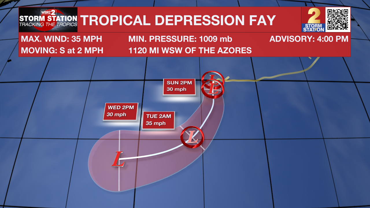
The Tropics: Strong winds and dry air have stripped away most of Tropical Storm Fay's thunderstorms, keeping it weak with steady winds around 35 mph. The system is currently drifting slowly south, but is expected to turn westward early next week as it moves with the surrounding air currents. While the ocean water beneath Fay is warm enough to fuel a storm, the surrounding harsh wind shear and dry air will prevent it from organizing or gaining strength. As a result, Fay will remain a weak tropical depression as it pulses with brief spurts of activity before fading away completely by the middle of next week.
Meanwhile, a trough of low pressure located several hundred miles to the southeast of Bermuda is currently producing an area of disorganized showers and thunderstorms. Environmental conditions appear somewhat favorable for gradual development of this system as it moves northward this weekend and then turns eastward by the early to middle portion of next week.
– Balin
The Storm Station is here for you, on every platform. Your weather updates can be found on News 2, wbrz.com, and the WBRZ WX App on your Apple or Android device. Follow WBRZ Weather on Facebook and X for even more weather updates while you are on the go.
More News

