Saturday AM forecast: Rain arrives tonight. Heavy rain possible Monday
Moisture returns from the Gulf, setting the stage for widespread rainfall late tonight into Sunday. An even stronger system arrives on Monday and continues into Monday night, bringing the potential for heavier rain and a few thunderstorms near the coast. This marks the beginning of a more unsettled stretch of weather as we head into the new week.
Football Forecast: For the game in Norman, OK, expect cool, breezy conditions with showers ending around game time. Temps will hover in the mid-50s, and gusty winds could make it feel a bit colder. At Southeastern Louisiana in Hammond, the weather should stay mild and mostly dry — highs around the upper 60s with comfortable humidity, especially through the weekend. For Bayou Classic in New Orleans. Clouds will be around, but obviously, perfect weather conditions inside the Superdome.
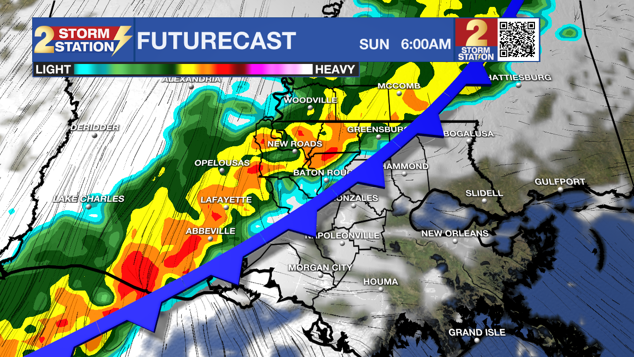
Today and tonight: Clouds will steadily thicken today as moisture returns from the Gulf. Temperatures will climb back into the upper 60s and lower 70s with a southeast breeze. Through the evening and overnight, a fast-moving disturbance and an approaching front will bring rain into the region. Most of the rain will fall after midnight, and totals by sunrise Sunday could reach a half inch to around an inch, mainly with a broad area of post-frontal stratiform rain.
Trending News

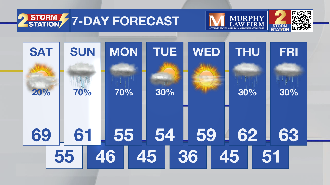
Up Next: The front will stall along the northern Gulf on Sunday, keeping much of the area cool, cloudy, and occasionally damp. Temperatures will vary sharply across the region—upper 50s to lower 60s north of the front and upper 60s to lower 70s closer to the coast. Light rain may linger into Monday morning as weak lift continues over the cooler air.

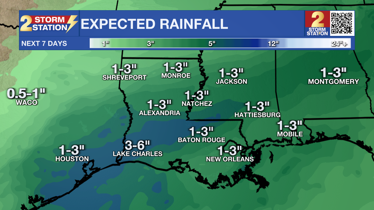
A much stronger system will arrive from Monday into Monday night. A developing Gulf low will move directly through the region, bringing widespread moderate to heavy rain. Deep moisture and strong upper-level forcing will support totals of 1 to 3 inches. Most places will stay too stable for thunderstorms, except for the offshore waters.
Dryer and colder air arrives Tuesday with highs only in the mid-50s and widespread 30s by Wednesday morning. After a brief break, another disturbance may bring rain back as early as Thursday and Friday, though forecast confidence decreases late in the week.

Tropics: No tropical development is expected anywhere in the Atlantic, Caribbean, or Gulf over the next 7 days.
Get the latest 7-day forecast and real-time weather updates HERE.
Watch live news HERE.
– Dave
The Storm Station is here for you, on every platform. Your weather updates can be found on News 2, wbrz.com, and the WBRZ WX App on your Apple or Android device. Follow WBRZ Weather on Facebook and X for even more weather updates while you are on the go.


.png)
