

Latest Weather Blog
Saturday AM Forecast: Cooler air has arrived, lows reach the 40s overnight
A strong cold front has passed, bringing much cooler and breezier air to the Capital Area. The lowest temperatures since last Spring will occur overnight, with lows in the 40s.
Weekend Temperature Tumble: The cold front is officially behind us! A sharp northeast breeze blowing around 10 to 20 mph will keep Saturday afternoon fairly cool, holding highs in the mid-70s. Expect a chilly start to Sunday morning, with temperatures dropping into the upper 40s and lower 50s, particularly north of the I-12 corridor. Sunday afternoon will warm up just a touch compared to Saturday, but we’ll remain comfortably in the 70s to round out the weekend.
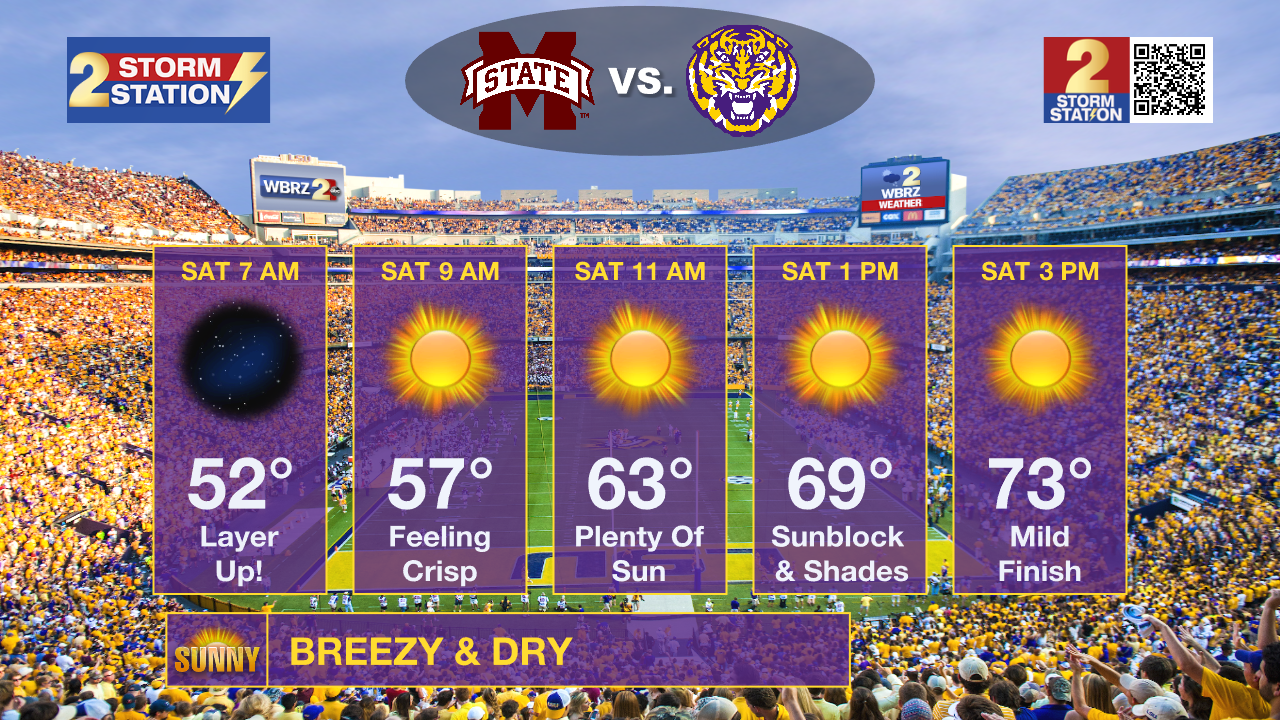
LSU Homecoming: Expect ideal autumn weather for Saturday's game! Following Friday’s cold front, early tailgaters will want a jacket, as morning temperatures sit comfortably in the 50s. Skies will stay bright and clear, warming things up into the 60s around kickoff and peaking in the 70s by the fourth quarter. With dry air and a steady breeze in the forecast, throwing lip balm and lotion into your bag is a good idea—and keep the sunscreen nearby for a clear, sunny afternoon in Death Valley.
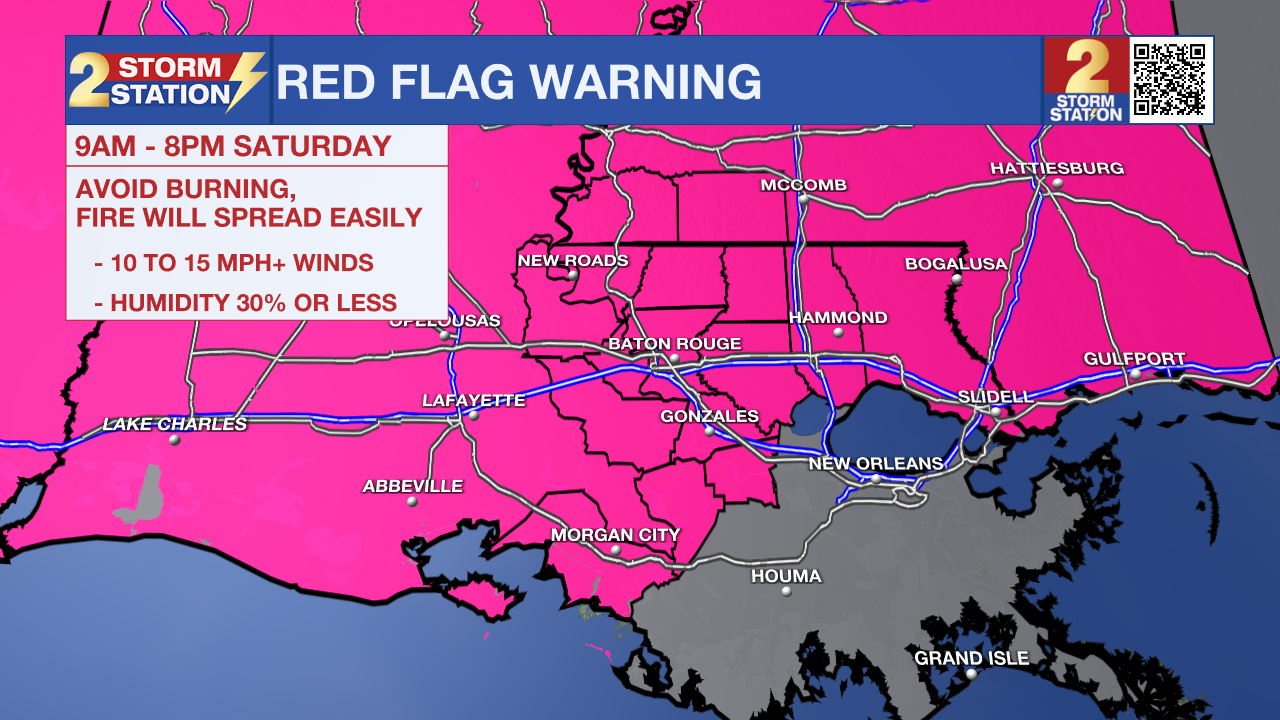
Fire Weather Danger: A dry atmosphere combined with gusty winds will bring a heightened threat for wildfire activity on Saturday. Because humidity levels are projected to drop to their lowest points during the day, even a tiny spark can ignite a fire that quickly gets out of control. Consequently, a Red Flag Warning is in effect—please refrain from open outdoor burning. If you plan on grilling or lighting any flame outdoors, be sure to monitor it continuously.
Trending News
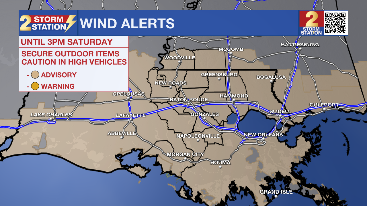
Wind Advisory: A wind advisory is in effect until 3 pm Saturday as north winds of 15 - 25 mph are expected with gusts up to 35 mph. These winds will blow around unsecured objects. Tree limbs could be blown down, and a few power outages may result. Winds this strong can make driving difficult, especially for high-profile vehicles.
Hazardous Marine Conditions: If you have plans to be out on the water through Saturday, you will likely want to rethink them—particularly if you are driving a smaller boat or lack experience in rough conditions. A Gale Warning has been issued as strong, gusty winds are set to churn up choppy waters across local lakes and rivers.
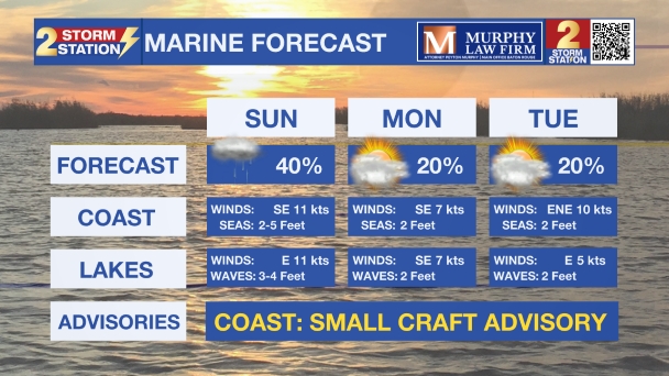
Up Next: Following the significantly cooler weekend, temperatures will slowly rebound next week. Dry air will remain in place, however, keeping rain chances generally slim.

Get the latest 7-day forecast and real-time weather updates HERE.
Watch live news HERE.
The Tropics: All is quiet in the Atlantic, Gulf, and Caribbean. No tropical development is expected over the next seven days.
— Balin
The Storm Station is here for you, on every platform. Your weather updates can be found on News 2, wbrz.com, and the WBRZ WX App on your Apple or Android device. Follow WBRZ Weather on Facebook and X for even more weather updates while you are on the go.
More News

