

Latest Weather Blog
Friday PM Forecast: parade plans and pleasant weather ready to roll
This weekend's weather will be close to perfect for early March as no impacts are expected for parades rolling through the Capital Area. Next week, the weather pattern will become more active as we near Fat Tuesday and Ash Wednesday.
Tonight & The Weekend: Overnight lows will fall to the middle 40s under mainly clear skies. Saturday will sport a high near 78° with sunny skies. Sunday will also start off in the middle 40s, but highs in the middle 70s will be a few degrees cooler than Saturday, thanks to a very weak front moving through. Both days will feature dry conditions, light winds, and sunny skies- great weather for all Mardi Gras parades!
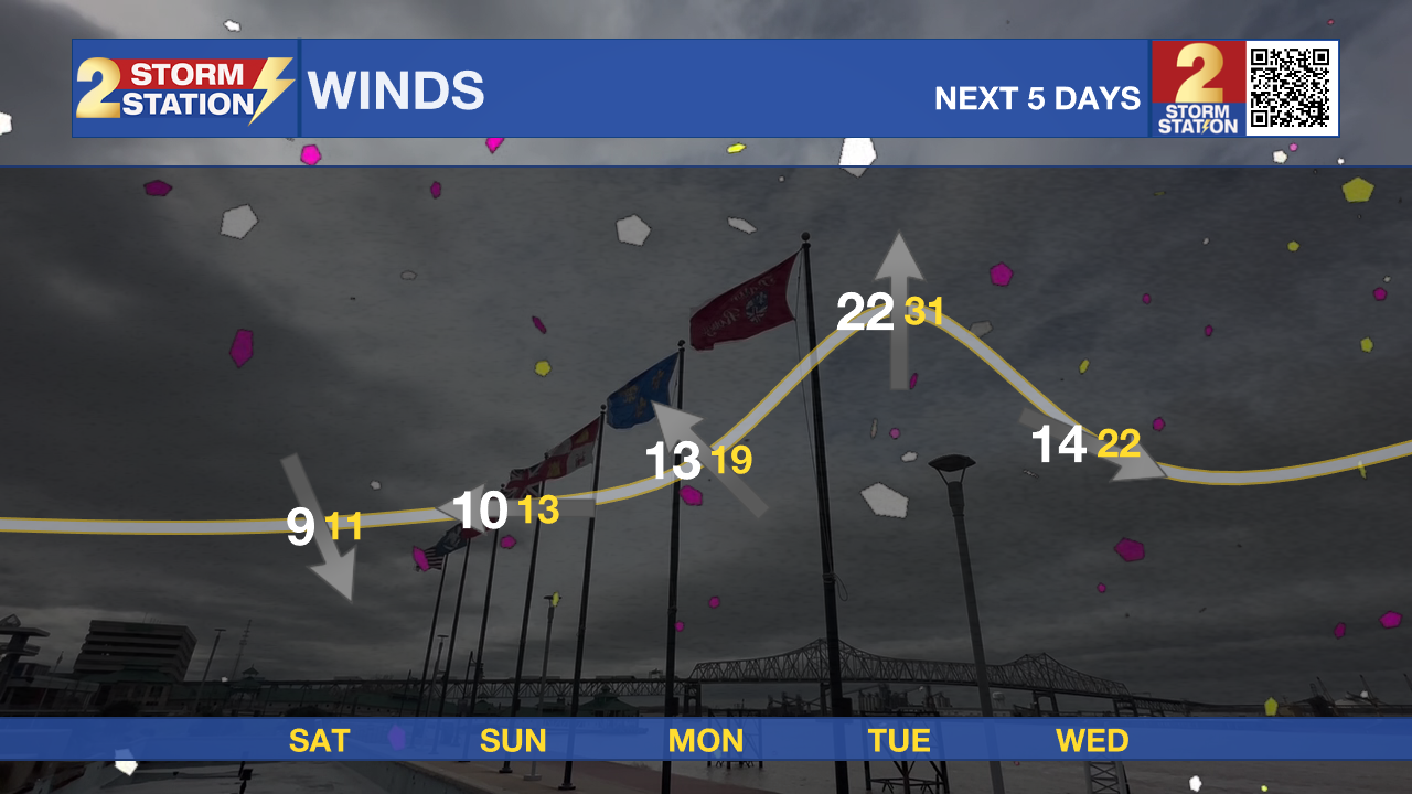
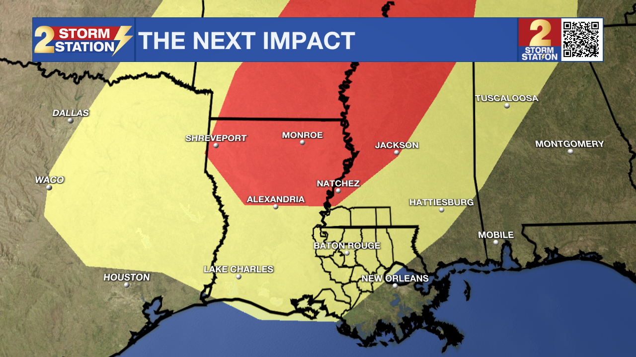
Next Impact, Next Week: On Monday, clouds and humidity will begin to increase as a warm front lifts through the region. The chance for spotty showers continues to trend lower, and no major impacts to outdoor events are anticipated. By Mardi Gras Day, the Storm Station will be tracking a line of strong storms set to move across the southeast ahead of a cold front. This storm system will form early Tuesday morning in Texas and move east throughout the day. Ahead of this front, partly sunny skies and warm temperatures should prevail for the majority of Fat Tuesday. Wind could be problematic as it is forecast to be around 20 – 30mph for much of the day, with occasional gusts to 40mph. Floats in transit to and from parade routes could be difficult to manage, and parade throws and trash will be blown around. While a stray shower can’t be ruled out during the day, the latest data suggest the greatest coverage of showers and storms will arrive in the Capital Region Tuesday night. As of now, isolated severe thunderstorms look possible, but those chances will increase north of the state line, where much better ingredients will exist.
Trending News
Rain and thunderstorms are expected to be finished by daybreak on Ash Wednesday. Temperatures will come down just a few degrees behind that front but not drop. Another storm system could arrive before next week is over.
Get the latest 7-day forecast and real-time weather updates HERE.
Watch live news HERE.
– Josh
The Storm Station is here for you, on every platform. Your weather updates can be found on News 2, wbrz.com, and the WBRZ WX App on your Apple or Android device. Follow WBRZ Weather on Facebook and X for even more weather updates while you are on the go.
More News
